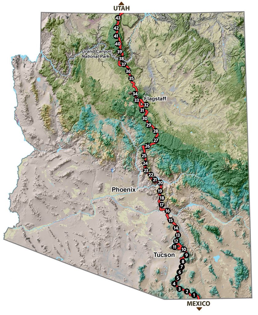
The Arizona National Scenic Trail stretches for 1,288km (800 miles) across the entire length of the state, connecting deserts, mountains, forests, canyons, wilderness, history, communities and people.
This non-motorized trail showcases Arizona’s diverse vegetation, wildlife and scenery, as well as unique historic and cultural sites. The route provides unparalleled opportunities for hikers, mountain bikers, equestrians and other trail users.
Starting at the U.S.-Mexico border, the path climbs and descends from one “sky island” mountain range to another, gaining and losing thousands of feet in elevation and traversing biomes ranging from desert to boreal forest. Continuing across the Sonoran Desert, the route crosses the Gila River, winds through the Superstition Mountains and the Mazatzal Wilderness on its way to the Mogollon Rim and majestic San Francisco Peaks. The trail north takes travelers across the Grand Canyon through billions of years of geology. Topping out on the North Rim, conifer forests dominate the Kaibab Plateau, eventually giving way to red bluffs dotted with sagebrush as the trail nears the Utah border on the edge of the Vermilion Cliffs National Monument. It is the backbone of Arizona.
The route is divided into 43 passages, and categorized into Southern, Central, and Northern sections, with lots of detailed information, history, stories, maps etc available on the links below.
Interactive route map (arcgis.com)
Route type: Long Distance Point to Point